Farming forecastor was originally developed as grazing management tool to assist in feed management, stocking rates and pasture management. The site collects and maps data from soil moisture probes located throughout the region. With moisture readings taken at 10, 20, 40 and 60cm depth, land managers can use this data to plan their planting, grazing or other groundwork three to four months ahead. Some example scenarios of how farming forecastor data is being used outside of pasture management include:
- Revegetation work planning – land carrying capacity for species plus forecast watering regimen.
- Weed control strategies – timing the removal of unwanted ground cover (weeds) to minimise top soil erosion while new plantings take root.
- To help interpret soil microbe results – low soil moisture generally correlates with low total microbes and subsequently slower plant growth.
- Conservation site management – measuring soil moisture retention over time as a measure of site health.
In addition to fieldwork applications, this tool provides educators with a rich, dynamic and engaging data set for lessons in Agriculture, Math, Geography, Earth Science, General Science, Technology and more. Measuring, monitoring and responding to the weather is such a natural thing for us humans to do but we often take it for granted. Maybe it’s time we put taking about the weather back at the top of our ‘to do’ lists. It really is fascinating!
This map shows the location of moisture probes located in and around our region and here’s a link to the farming forecaster site so you can have an explore.
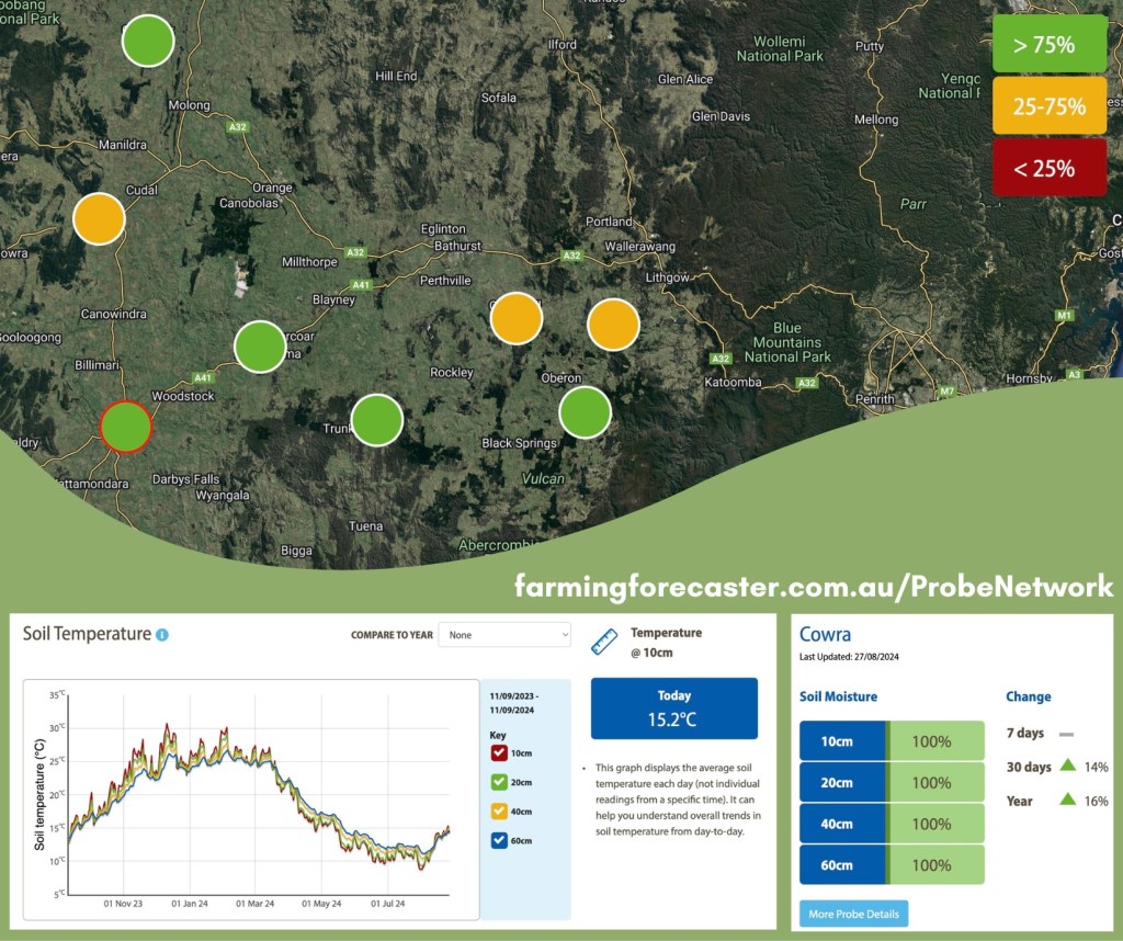
We’ve embedded a link below to help you learn more about this management tool and will also direct you to the Farming Forecaster Training Resources page to learn more about interpreting and using the data.


