Five key citizen science data types can be used to inform extinction risk assessment based on the IUCN’s (International Union for Conservation of Nature) Red List criteria.
Read the full Fungimap article here: A win for citizen science and fungimap article
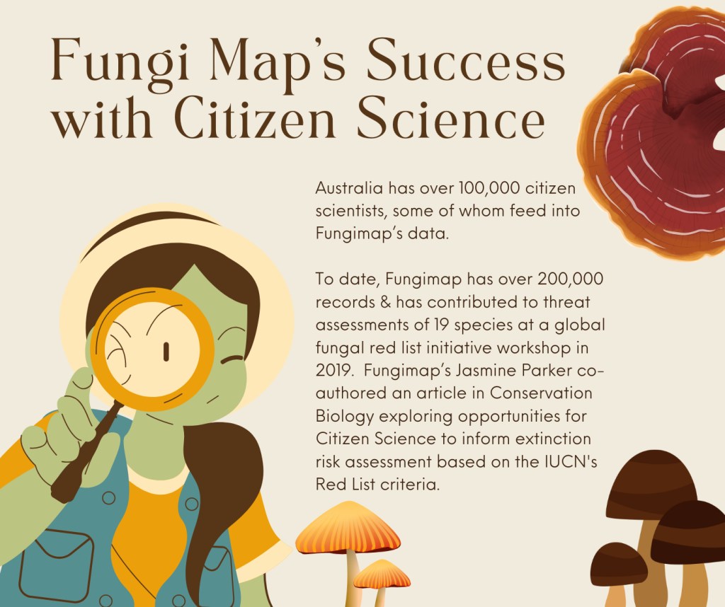
Those of you who know Mid Lachlan Landcare know that we’re both mycology and citizen science enthusiasts, sharing our passion for both accross many events, including Mycology May & the Great Southern Bioblitz each year. So, when our friends at Fungimap published a link to some interesting reserch that combined these two passions, we just had to give it a closer look…
Citizen Science data can directly inform the process of species’ assessment and be used to target conservation actions.
Read the full Conservation Biology article here: Incorporating citizen science into IUCN Red List assessments
To date, most citizen science data fits under the classification of ‘occurance data‘ i.e: what you saw, where you saw it. This data is often but not always accompanied by geotagged photographic or sound recording data. Collecting this data is what we focus on doing during events such as the Great Southern Bioblitz and Mycology Map, leaning on machine learning and expert validation, to increase the accuracy and usability of this data. These one-off records are currently useful for informing conservation organisations and initiatives of where more formal work could be targeted but fall short of being usable in red list scenarios.
The article in Conservation Biology offers a SWOT analysis approach of Citizen Science, culminating in some suggestions as to how we could all get more bang for our buck so to speak!
Below, I’ve summarised the other levels of data collection Citizen Scientists might engage in. See the full article for a more thorough breakdown.
Following on from occurance data is presence/ absence data. This is not as simple as it may initially seem as while observing something directly clearly correlates to its presence, not observing it directly doesn’t always indicate absense. Presence/ absense data often requires more ecosystem knowledge – an ability to ‘read the wider scene’. It often also requires multiple visits over different seasons, looking for the presence or absense of specific environmental clues.
Structured Surveys are another extension to the above and a way in which citizen science could be utilised more deeply. These are typically more tightly bound to a specific location and time-frame and require both quantitative and qualitative data to be recorded e.g. counts, measurements, activity levels plus landscape features, land -use and current conditions).
As the level of data required to be collected by the citizen scientist grows, so too does the requirement for training and time input. Many citizen scientists are drawn to take part because it’s fun being casual enough to be accessible by everyone yet valuable enough to feel meaningful. Citizen scientist events such as The Great Southern Biobiltz show the average citizen scientist will be drawn towards a certain section of the landscape be that flowering plants, grasses, bugs, birds, fungi or trees. Few feel comfortable recording across multiple species. This inevitably leads to data gaps in the Landscape which could remain significant in some cases.
Expanding the collection of Pysical Samples such as the water collected during our eDNA survey are another way Citizen Science can be developed to expand quantitative data collection without requiring survey participants to learn a wide variety of new skills. For example, the eDNA sample collecting carried out under the Odonata foundations threatened species project only required the citizen scientist follow a set of simple sampling procedures.
Narratives are a story-telling / oral history approach to data collection and can be highly valuable in providing a context from which the sample or data was collected. This data collection method can inform presence/ absence data by providing historical context and insights as to how the landscape has been used and/ or changed over a more expansive period of time. We found narrative data useful in our Soil Microbiology project, collecting oral histories of land management decisions over the weeks, months and years prior to sampling to give us an idea of how altered the soil environment has been from a human-impact perspective.
It’s exciting to see Citizen Science kicking goals and making an impact in the world. We can’t wait to see how this article and research helps to shape the future for our citizen science based projects and the ecosystems that we are measuring.
About the IUCN: IUCN org
- Founded in 1948 in the French town of Fontainebleau
- IUCN is a membership union that brings government and civil society organisations together with a global network of experts. There are currently over 1400 members globally.
- The IUCN has become a global authority on the status of the natural world & measures needed to safeguard it. IUCN has representatives from over 160 countries.
- Aims to encourage international cooperation and provide scientific knowledge and tools to guide conservation.
- The IUCN’s Red List of threatened species was established in 1964. This has evolved into the most comprehensive data source on global extinction risk
- In 1971, IUCN played a fundamental role in creating the Ramsar Convention on Wetlands, followed by the World Heritage Convention (1972), the Convention on International Trade in Endangered Species (1974), and the Convention on Biological Diversity (1992).


