Mid Lachlan Landcare
supporting sustainable agriculture and restoring the environment
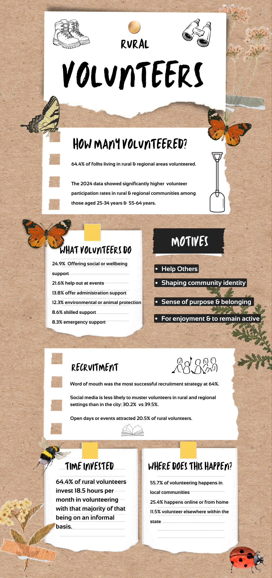
2024 NSW State of Volunteering -Focus Group Reports. Rural Data Summary
Each year the NSW government publishes an in-depth set of reports analysing the work volunteers do across the state and its value to our ecomony. As a volunteer-based organisation, Landcare groups such as ours compare this big-picture data to that which we collect locally in a bid to better understand the capacity that exist here in the Mid Lachlan Region. We then use those insights in our priority work plan to ensure the grants, resources & opportunities we invest in are both deliverable and desirable to you, our community.
We’ve pulled out some key data from the rural and regional volunteers chapter of the report and collaited it in an infographic below. You can read the full set of reports by following this link to the NSW government website where all of the reports can be downloaded for free.
We’d like to take this opportunity to again thank all of our existing volunteers and remind you all that Mid Lachlan Landcare is free to join and has a ‘no obligation’ policy meaning you can come along and get involved in as much or as little as you like/ can. Joining is easy simply email our office and ask to be put on our mailing list. In our newsletter you’ll find events, grant opportunities you may wish to apply for, interesting media links and an update on what our team has been up to that month. Landcare is for everyone!
Look forward to welcoming you along.
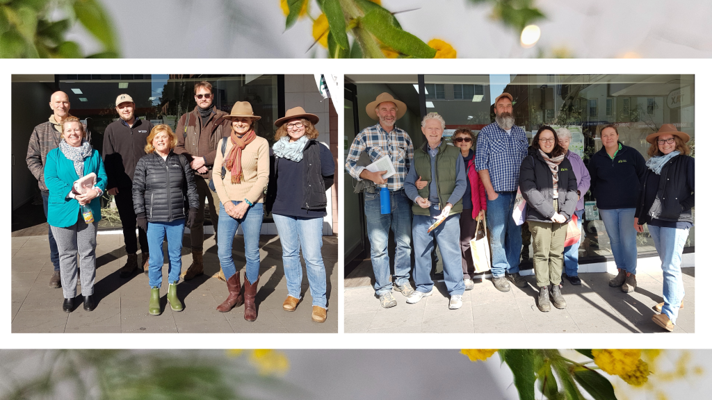
Central Tablelands Landcare Muster – Welcome to our Backyard

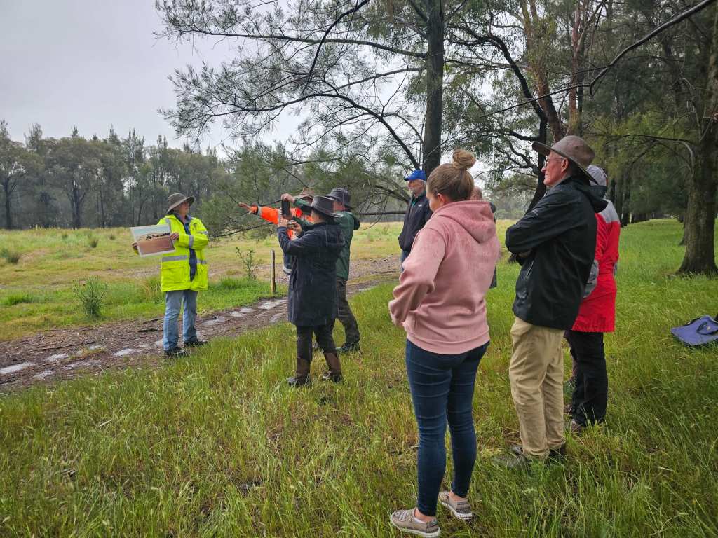
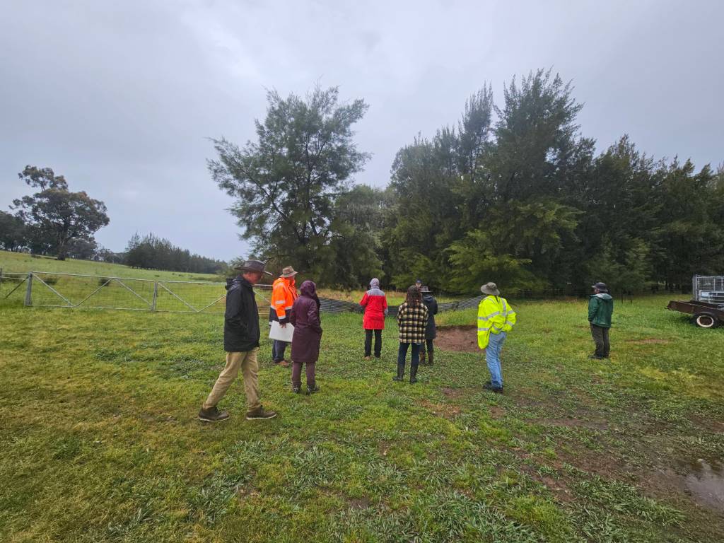

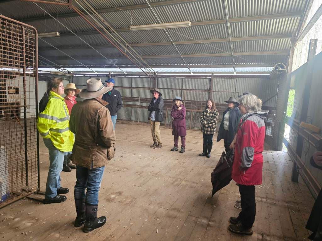

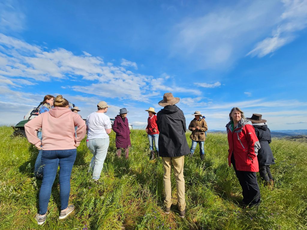


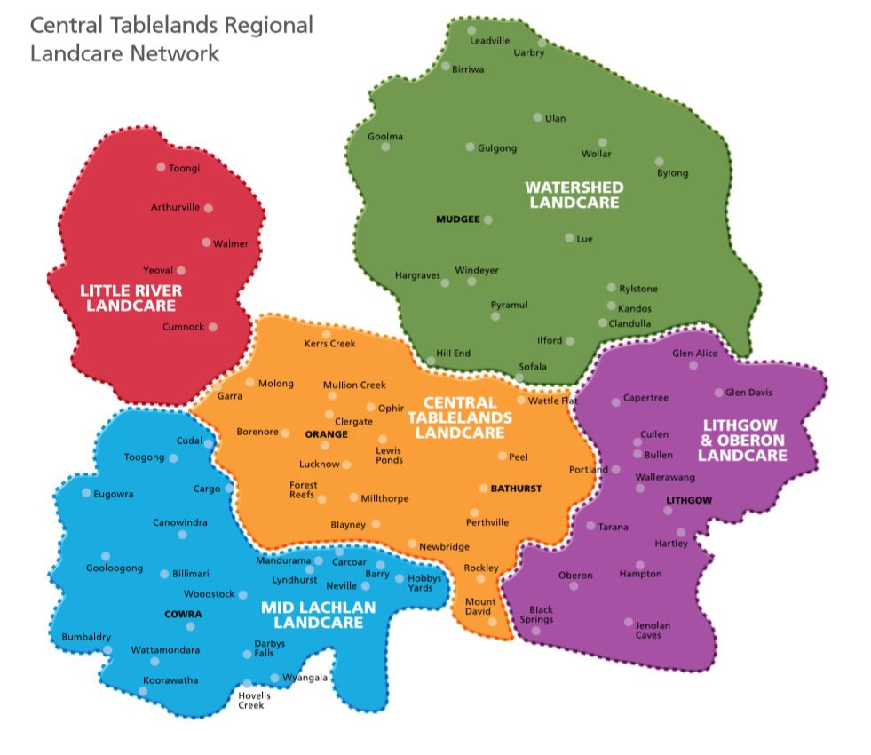
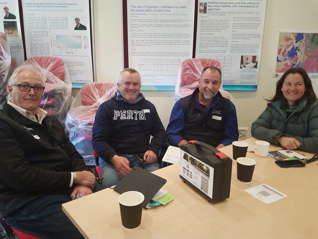
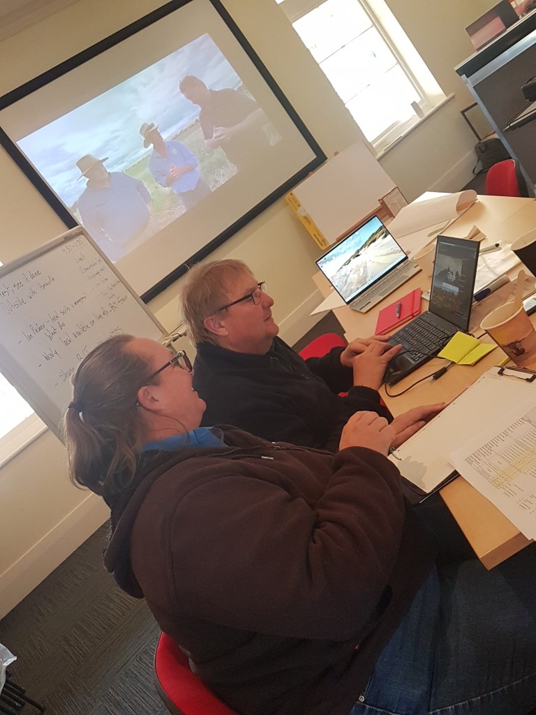
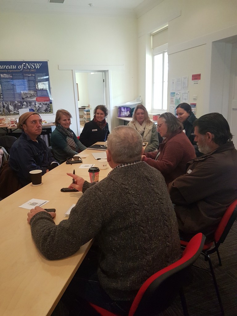
Mid Lachlan Landcare sits in the Central Tablelands Landcare region along with Little River, Central Tablelands, Watershed, and Lithgow and Oberon Landcare groups. Funding from the Landcare Enabling program has made it possible for Landcare groups across New South Wales to employ full time co-ordinators, organised into regional teams. This week, our regional team got together to identify opportunities for us to work more closely together. We explored the benefits that might flow from economies of scale and worked on how we can create an environment for the cross-polination of ideas. A proposal focusing on how we might go about better understanding what drives people to volunteer was put forward, and we also spent time scoping out a plan for increasing our funding capacity. Finally we recognised the wisdom within Landcare networks such as ours and brainstormed how that might best be captured. It goes without saying that we also relished the chance to get to know each other, our facilitating team and our Local Land Services guests a little better.
While each of our Landcare patches differs in their ecological priorities and comminities land-use practices, demographics & interests, it was clear that we also have so much in common. I’m sure I’m not out of line in saying that we’re all focused on delivering even better value for our communities as a consequence of the time spent together.

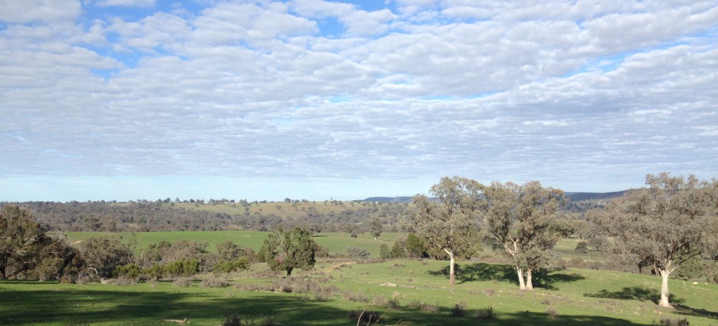
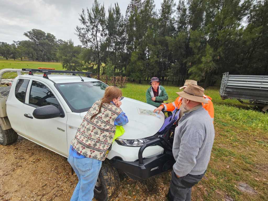
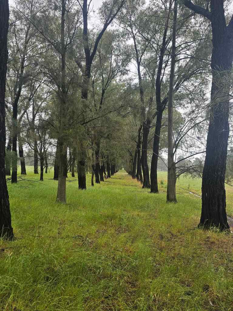
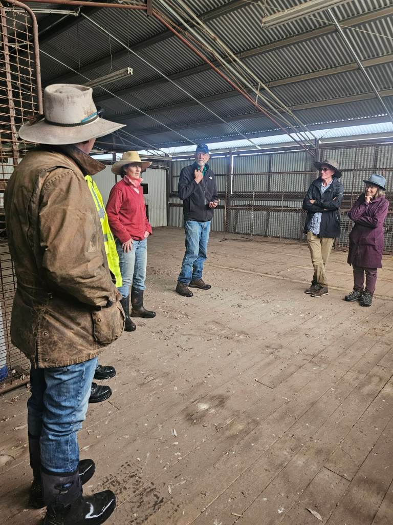
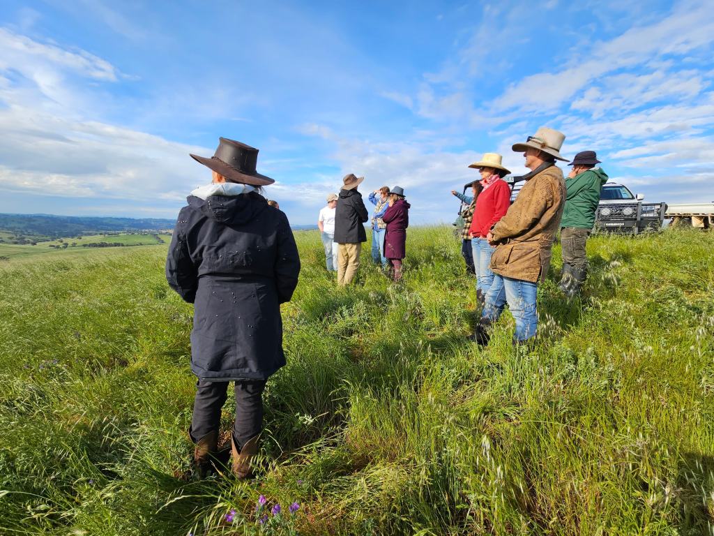
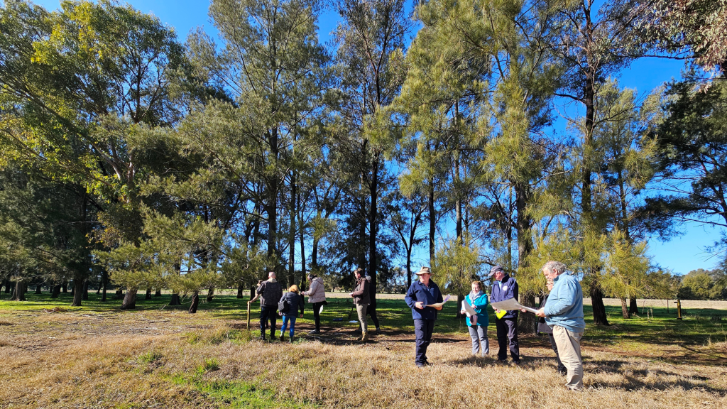
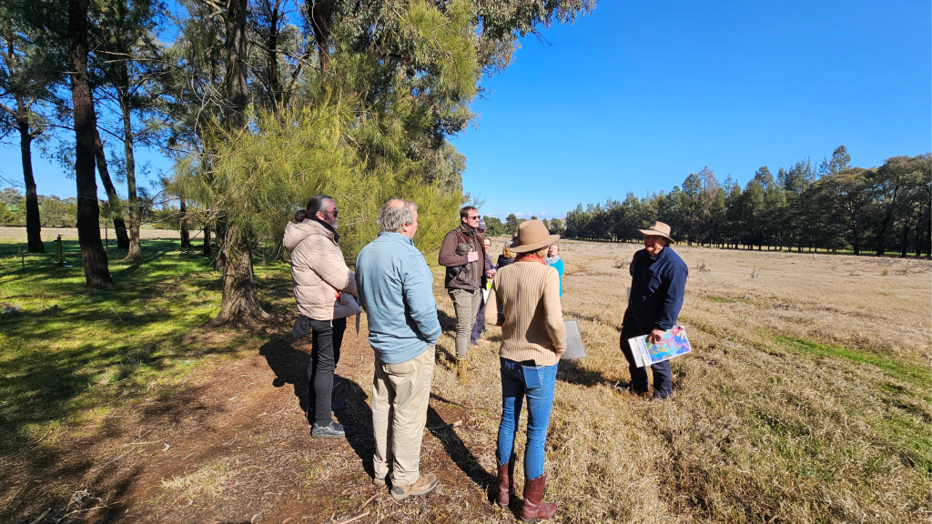
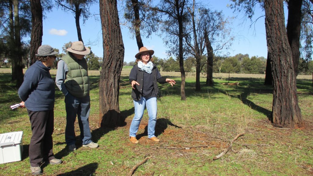
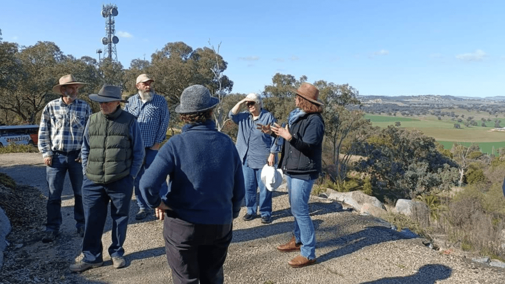
Before we sat down to our two-day workshop, we took the opportunity to invite our Central Tablelands team members on a farm tour. We were delighted with the interest in this activity and super grateful to have Salinity expert and Organic grazier Wooly (Andrew Wooldrige), cattle grazier Anna Hickman and our Growing the Grazing Revolution Champion Scott Hickman on board to share their time and insights among the group. There’s no better way to learn than to go out on country and immersing one’s self in farm life. It truly helps you see, touch, taste and smell how sustainability and land conservation work from a farming perspective. It was lovely to be able to share that opportunity with our network and have them experience first-hand what it’s like to stand on top of the world (Woodstock) and be serenaded by a mob of cows who feel the grass looks greener on the other side of the fence (where we’re standing)!
“As we work on the land, the land works on us” Steve Fleischmann, Lithgow & Oberon Landcare
Native Plant Identification for Landholders in Parkes & Wellington
Local Land Services are hosting two plant identification days in October. These events are part of the Threatened Ecological Communities on Farms project which is funded by the Australian Government Natural Heritage Trust and delivered by Local Land Services, a member of the Commonwealth Regional Delivery Partners panel.
To book your spot or to receive more information please contact Stephen Pereira using the information on the flyer.
9th October: Parkes
10th October: Wellington

Future Drought Fund-Farm Business Resilience Program. Weeds as Indicators of Soil Health
Last week we participated in an online workshop on weed management and it was so good, we just had to share it here! One of the big take-home messages for us was the value of a curous mindset – learning what weeds are telling us about soil health including soil microbiology, about our land management practices and about our environment as a whole.
Below we’ve highlighted some key moments from the webinar for those of you who want to skip forward or re-play a specific part:
11.30: How are we looking at this (weeds) problem
14.00-16.40 : The characteristics of weeds – Weeds holding the soil together and filling gaps in our ecosystem, recycling nutrients, improve soil carbon, provide nutrition, provide ecosystem services (pollen) & break up compacted soil
17.00-18.30: Weeds as early succession plants – a diagram by Dr Elaine Ingham (community dynamics).
20.00: Transitioning Soil Biology (Bacteria:Fungi Balance)
21.20: Weeds that come about when the decay/ recycling function of soil is not working.
22.00-24.00: Germination Signals and the weed seed bank – the impact of weather, environmental impacts & land management practices
25.30: 6 reasons weeds grow by Nicole Masters ‘For The Love Of Soil’
- Colonise bare soil
- Low soil organic matter
- Open up compacted soil
- Mineral imbalances
- Microbe imbalances
- Safety valve for toxins
26.40: Weeds that turn up when calcium and humus are low.
27.40: Weeds that thrive in compacted soil
28.00: Weeds that love high potassium, low phosphorous conditions
28.30: Weeds liking high nitrates
29.10: Weeds taking advantage of bare soils
29.50: Weeds that indicate fungal/ sleepy soils (a sign that stock density is low and soil may not be getting sufficient grazing inputs)
31.30: Non mycorrhyzal weeds that thrive in bacterial dominated soils.
32.00- 34.00: Grazing management to manage weeds
39.00 – Process for listening to weeds
- Observe plant characteristics in the field
- Observe and monitor soil health (including soil microbiology)
- Consider paddock history
- Research the plant
- Consider reasons weeds grow
- Consider ecological processes
- Monitor over time.
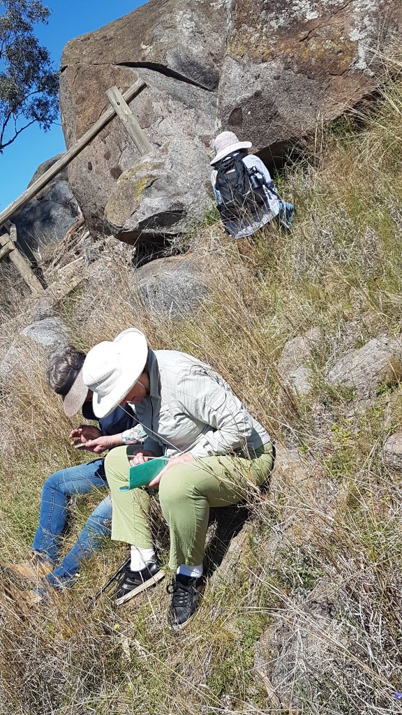
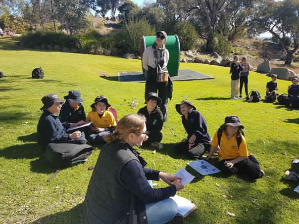
Bioblitz, Citizen Science & the iNaturalist App
This week we participated in The Great Southern Bioblitz, a citizen science driven ecological survey that runs for four days each spring.
Citizen Science: the collection and analysis of data relating to the natural world by members of the general public, typically as part of a collaborative project with professional scientists. Dictionary.com
A team of fifteen nature-loving individuals joined our Mid Lachlan Landcare event in Box Gum Grassy Woodland at Cowra’s Billy Goat Hill. Spending the morning photographing, audio recording and then uploading our findings to the Central Tablelands project site.
By the end of the session, our Central Tablelands group project had 65 active participants who’d together recorded 901 observations across 436 species – an amazing effort!

The Great Southern Bioblitz would not be as effective without the fabulous ‘iNaturalist’ app, an app that’s free to download and can be accessed at any time.
Tracee and I use the iNaturalist app throughout the year to record the plants, animals and fungi we come across when we are out and about in nature. We have our own project site ‘building connections for Biodiversity which currently has over 11,000 observations and close to 2000 species recorded by 33 people, most of which are located in the Mid Lachlan Region. Feel free to join us and add to our dataset!
In Australia, iNaturalist data feeds into the Atlas of Living Australia database, a data-set that’s helping inform and direct our policy makers, scientists and thought leaders. It’s also providing citizens like you and I with a high quality, community-built educational asset through which we are able to understand and appreciate the nature we find ourselves surrounded by.
It is a great tool to use to record all you find on your farm and surrounds and it’s especially great if we can record species found in Box Gum Grassy Woodlands to improve knowledge of these special woodlands.
You can find more information about iNaturalist in our video below.

The program is being funded by the NSW Government
through a partnership between the Saving our Species program
and the Environmental Trust.
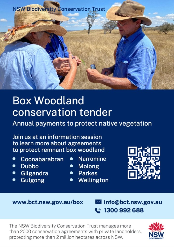
Box Woodland Conservation Tender Open Now for Cabonne LGA
The NSW Government’s Biodiversity Conservation Trust currently has a tender open for Box Woodland Conservation in the following local government areas: Warrumbungle, Gilgandra, Dubbo, Narromine, Parkes, Mid-Western and Cabonne.
Expressions of interest close on 29th September at 11.59pm.
To find out more and check your eligability please scan the QR code on this image or follow this link to the BCT tender page.
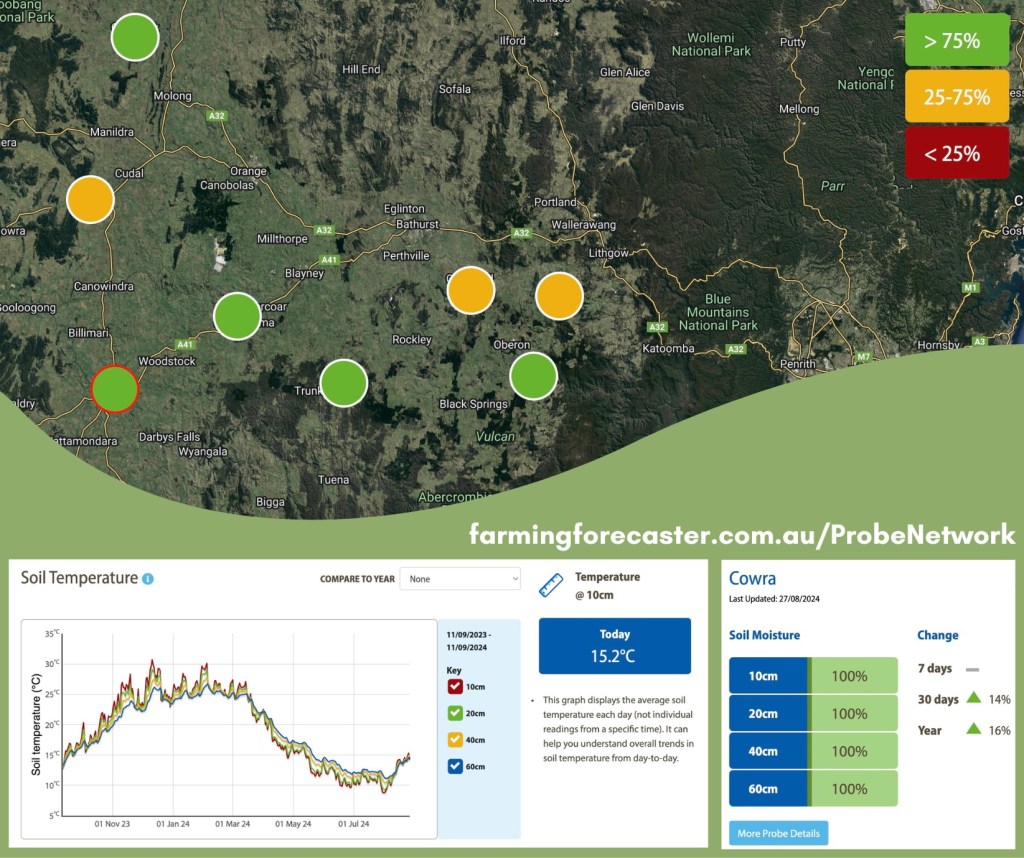
Farming Forecastor – Soil Moisture Probes of the Mid Lachlan Region
Farming forecastor was originally developed as grazing management tool to assist in feed management, stocking rates and pasture management. The site collects and maps data from soil moisture probes located throughout the region. With moisture readings taken at 10, 20, 40 and 60cm depth, land managers can use this data to plan their planting, grazing or other groundwork three to four months ahead. Some example scenarios of how farming forecastor data is being used outside of pasture management include:
- Revegetation work planning – land carrying capacity for species plus forecast watering regimen.
- Weed control strategies – timing the removal of unwanted ground cover (weeds) to minimise top soil erosion while new plantings take root.
- To help interpret soil microbe results – low soil moisture generally correlates with low total microbes and subsequently slower plant growth.
- Conservation site management – measuring soil moisture retention over time as a measure of site health.
In addition to fieldwork applications, this tool provides educators with a rich, dynamic and engaging data set for lessons in Agriculture, Math, Geography, Earth Science, General Science, Technology and more. Measuring, monitoring and responding to the weather is such a natural thing for us humans to do but we often take it for granted. Maybe it’s time we put taking about the weather back at the top of our ‘to do’ lists. It really is fascinating!
This map shows the location of moisture probes located in and around our region and here’s a link to the farming forecaster site so you can have an explore.
We’ve embedded a link below to help you learn more about this management tool and will also direct you to the Farming Forecaster Training Resources page to learn more about interpreting and using the data.
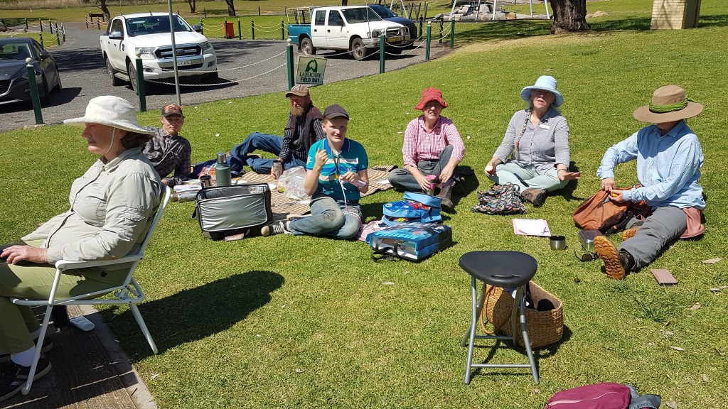
Landcare Week Pop Up Store & Mystery Bus Tour
‘Landcare is for everyone’ was the theme of this years Landcare Week and what better way to embody that than a pop-up-shop and mystery bus tour (or two) -yes, let’s take it very literally and show Landcare to everyone!
About the bus tours
We’ve been running catchment tours for local, regional and city based schools for many years, but we don’t often we get to run tours for the general public. This Landcare Week we wanted to extend the invitation to our local community and take them to see some of our collective stories around the Cowra area.
A whistle-stop tour of two sites allowed us to show how strategic tree planting and management play vital roles in erosion control, animal welfare & microclimate formation (via shelter belts) and salinity management. We explained the geological features of our landscape and how Cowra came into being, our precious native Box Gum grassy woodland habitat and the role we play in its regeneration, plus sustainable grazing practices & farm management.

About the Pop-Up Store
Being centrally located and open all week meant we could reach a broader and more diverse audience. Many people think of hard manual labor, tree planting and weeding when Landcare is mentioned and we wanted to expand that narrative to one that better reflects the diverse and interesting ways Landcare operates.
Mid Lachlan’s projects have included eDNA testing (Saving our species project with Odonata), Soil microbiome mapping (with the Microbiometer), Citizen Science (Bioblitz), Growing the Grazing Revolution, Box Gum Grassy Woodland Habitat on Farms and squirrel glider monitoring in the past in partnership with various organisations such as the CSIRO, Australian National University, the Biodiversity Conservation Trust, the Odonata Foundation and many more.
Our store was designed to bring the wonder and beauty of the Box Gum Grassy Woodland habitat we are surrounded by into the town. To make that as immersive as possible we distilled fresh Eucalyptus hydrosol all week, turning the store into an aromatic delight. Contributing to that were our displays of eucalypts and acacia’s from around the region plus six table displays showcasing different aspect of the work we do. Along with the curiosities and artefacts were a photo display plus a number of recent case studies from around the region to whett the apetite and highlight what’s possible when we work together.
Overall the week felt like a great success. The bus tours went well and the store was busy with drop-in visitors all week. We also managed to attract some press attention with the ABC’s Tim Fooks calling in and interviewing a number of our team members, plus a feature on Chanel 7 news.
You can listen to Tim Fooke’s interview’s here
Tracee & Amanda about Landcare Week.
David Wrenford about his Tree Change & The Water Monitoring Project he’s part of.
It was lovely to meet so many people and hear more about what Landcare means to them all and, more importantly, what they want to see from us (and be a part of) in the future.
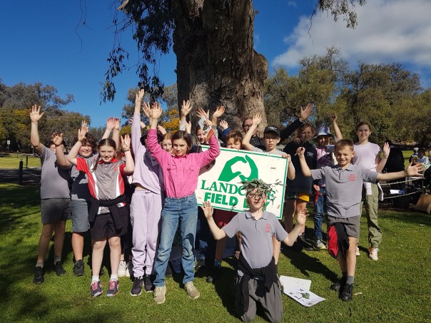
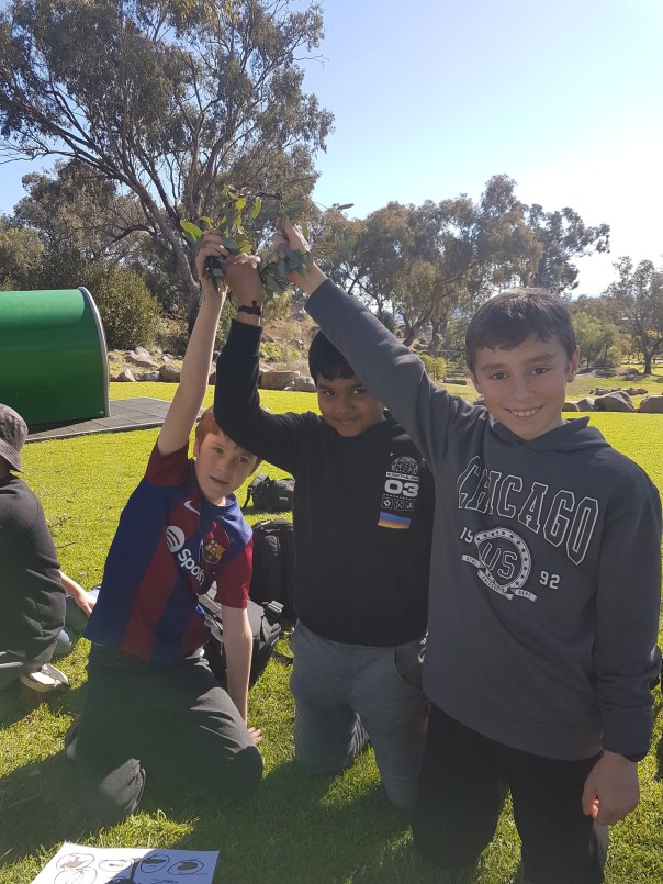
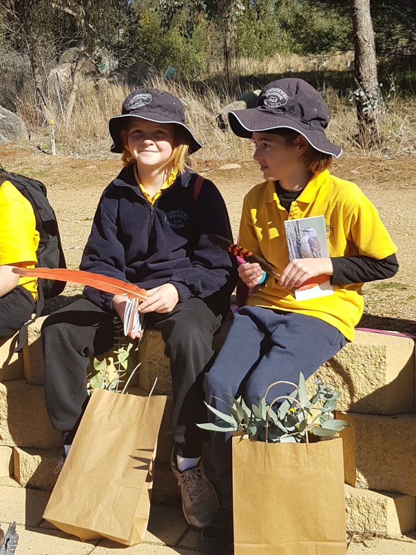
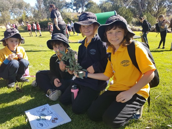
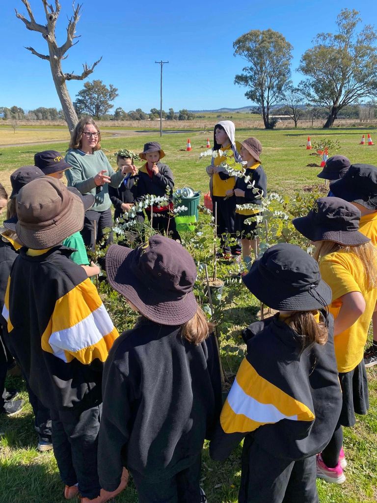
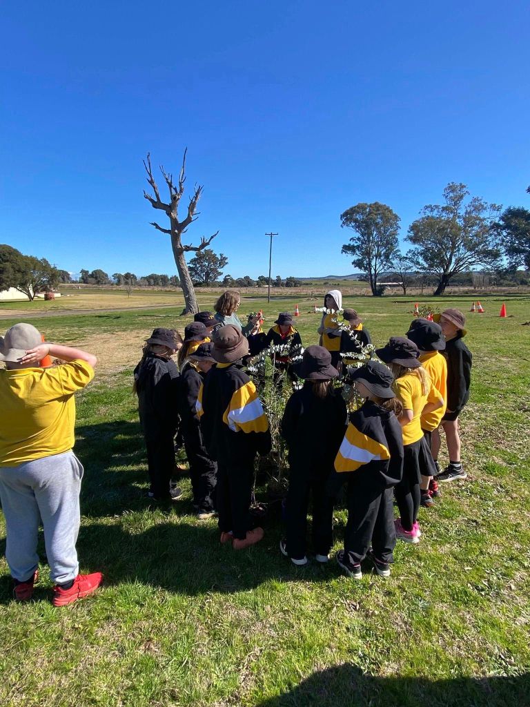
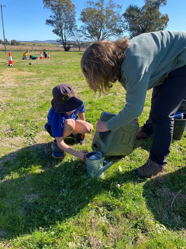
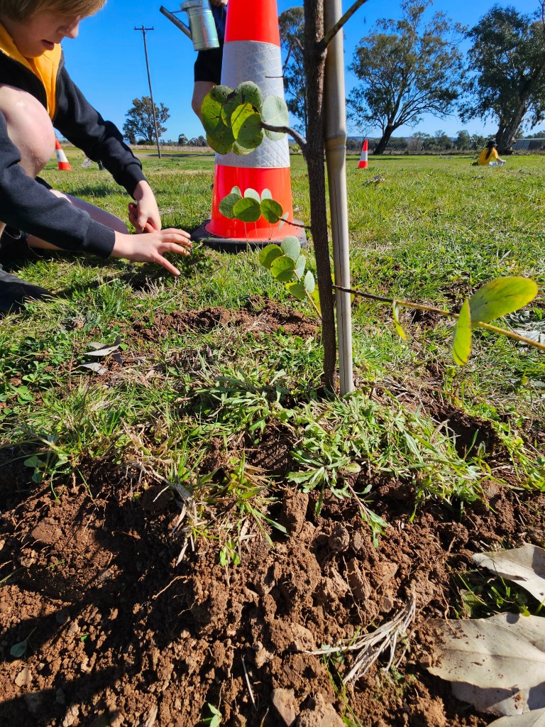
Celebrating National Tree Day
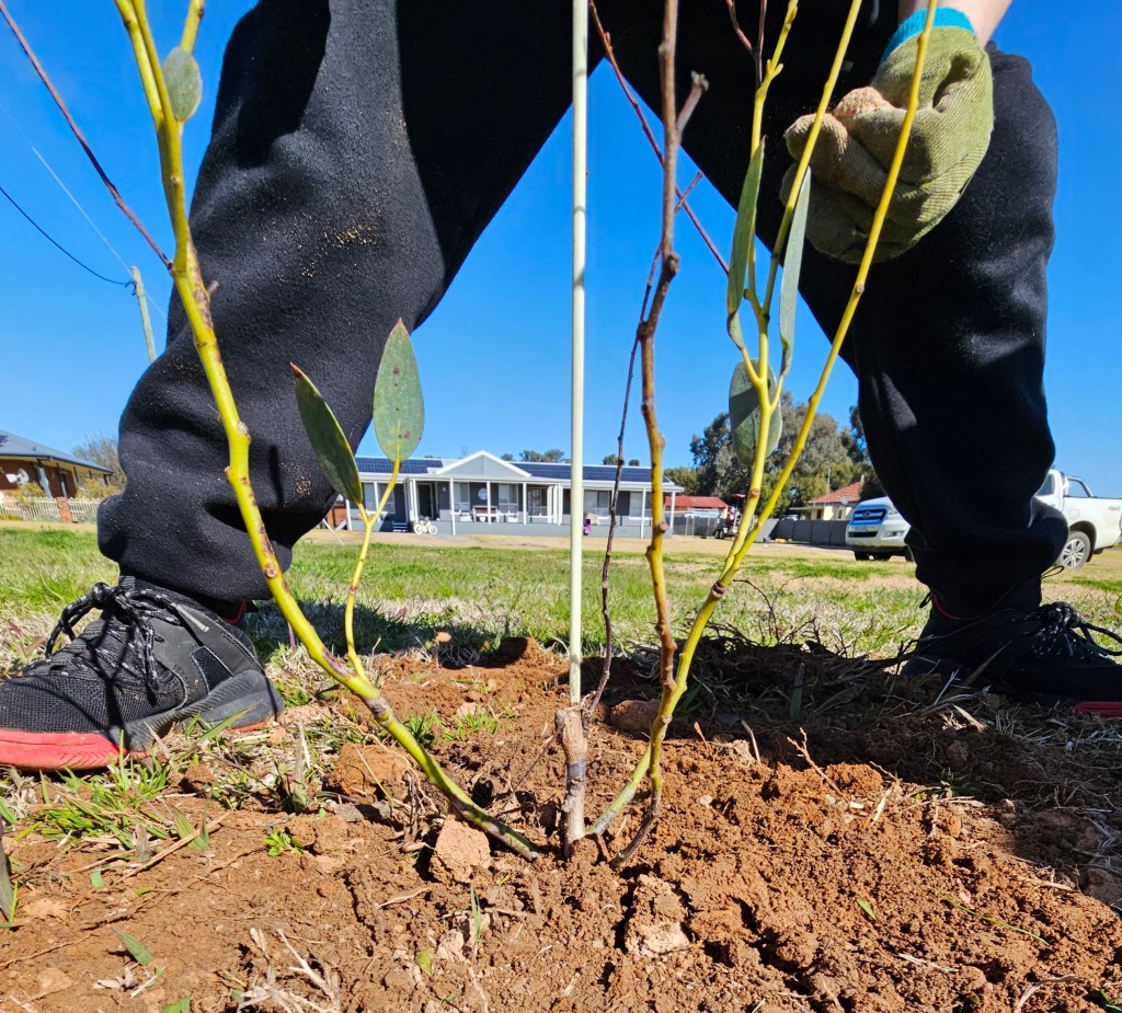
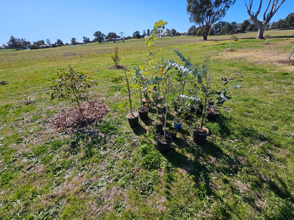
National tree day was established by Planet Ark in 1996 and has grown to become the largest community tree planting day Australia wide! While we are often out explaining that Landcare is not JUST about planting trees, tree planting remains such a vital part of many of the projects we take part in, including, of course, this one!
We joined two events this year, first up was Cowra Council’s school / community event at the adventure playground near to Billy Goat’s Hill and second was Canowindra primary school’s afternoon of planting sponsored by Cabonne council.
We had a lovely time playing our narrative listening game ‘Life around the Gum Tree/ Dingo (a bit like bingo’) and helping the students plant the trees and shrubs provided. We hope they all go on to grow big, strong and proud!
Cowra Council Tree Day Event.


Canowindra Public School Tree Day Event


Thanks to Cowra and Cabonne councils for supporting this amazing event and for all the schools and students who gave up some of their time to come along. We really loved meeting you all and appreciate your efforts.
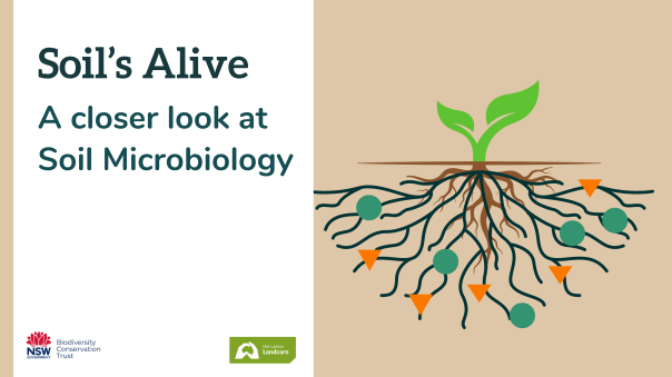
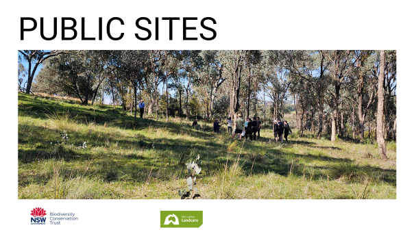
Soil’s Alive – Exploring the unique soil microbiome of the Mid Lachlan Region
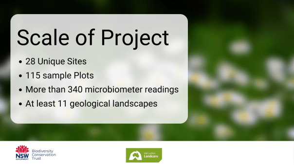
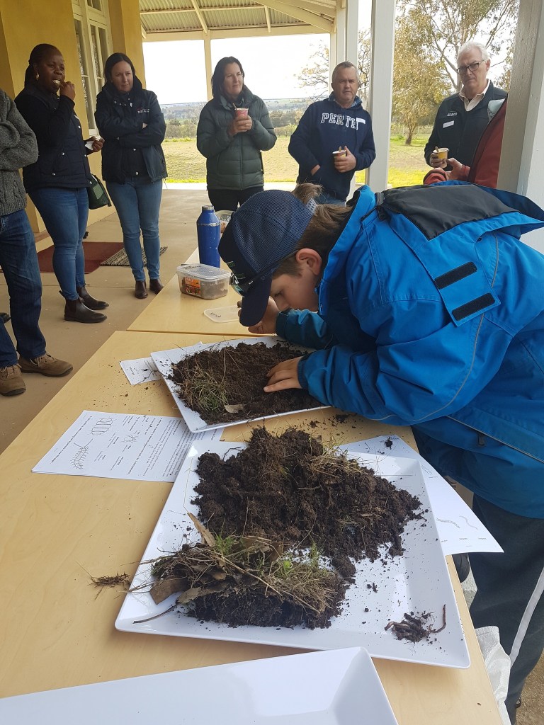
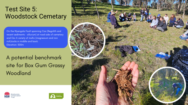
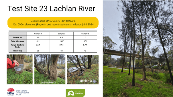
Over the course of eight weeks between May and June, Mid lachlan Landcare sampled the microbiome of twenty eight unique sites spanning from public (Cemeteries, Travelling Stock Reserves) to private (Cropping and Grazing farms). With each site being sampled an average of four times we ended up with one hundred and fifteen sample plots, each of which played a small yet important role in uncovering the rich and diverse microbiome of the Mid Lachlan region.
Why did we carry out this experiment?
There’s growing recognition that the soil microbiome plays a pivotal part in a healthy ecosystem. In the past it has been difficult for independent farmers, conservationists, gardeners and citizen scientists to assess their soil’s microbiome in a timely, cost-efficient and readily accessible manner.
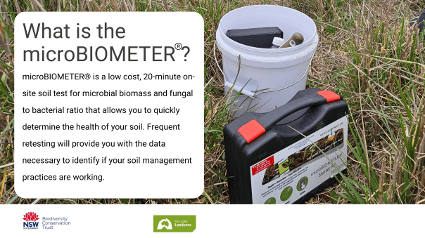
In investigating options to fill this gap for our community, we came across the microBIOMETER and decided to invest resources into answering the following questions:
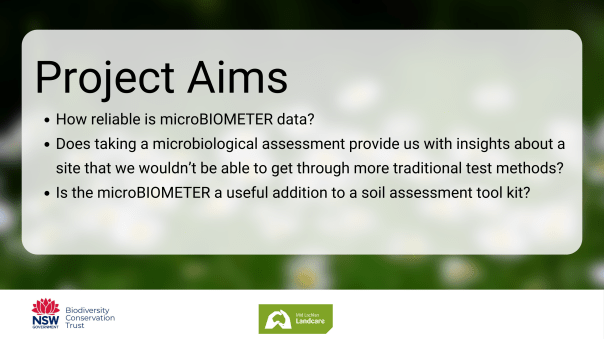
The overall goal of this project was to collect and analyse enough data to give us a meaningful data set for the region so that we might answer the above questions in an applied, narrative way that made sense to our community. We conclude that while the microBIOMETER has some limitations and is not the only way to assess soil microbiology, the insights it provides are useful as part of a soil assessment protocol for informing land management decisions over time.
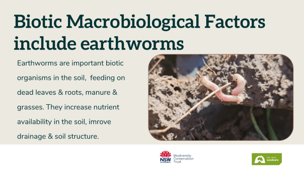
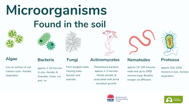
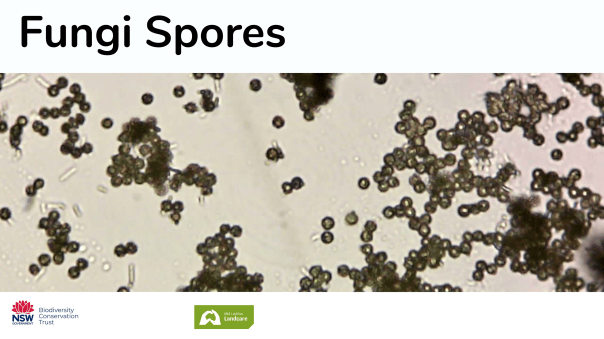
It’s estimated that each teaspoon of soil contains around one billion microbes representing somewhere between ten and fifty thousand species. For comparison a healthy human gut contains around one thousand species, each of which plays a role in how our bodies access and absorb nutrients and process toxins and waste. Soil microbiomes are no different, with fungi, bacteria and other microorganisms ensuring nutrients are both available and accessible to plants and that waste material is broken down and recycled safely and efficiently.
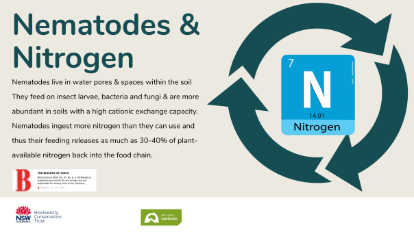
Soil microbiome research projects have exploded in number over the past five to ten years with conservation groups, farmers and horticulturists alike, seeing value in accomodating a microbiome-informed approach to their management plans.
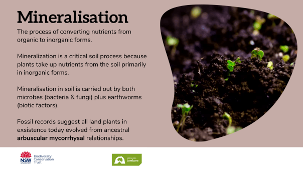
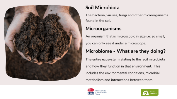
Soil Microbiome: The entire ecosystem relating to the
soil microbiota and how they function in that environment.
This includes the environmental conditions, microbial
metabolism and interactions between microbes.
With this in mind, Mid Lachlan Landcare set about designing a pilot project to map and model our regional microbiome with a view to better understanding where we sit currently – is our collective microbiome healthy – and potentially, where we could get to in the future. The resulting project was funded through the Private Land Conservation Matters project by the NSW Biodiversity Conservation Trust.
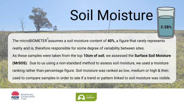
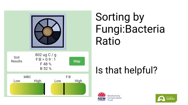
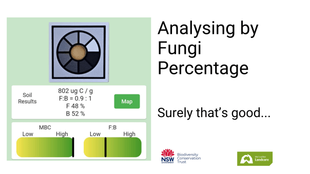
We were sampling from what’s known as the Rhiosphere – the top 10cm of soil or the space where symbiotic plant:microbe activity is most likely. The microbiometer® is a low cost device that can give you a value for the sites total microbes, fungi:bacteria ratio and fungi percentage within 20 minutes for less than $10 per test strip. The speed, cost and all round convenience of this test is what attracted us to it in the first place, sentiments that were shared by our community when surveyed during our field day/ results sharing event.
- Optimising our test method – what we learned about what to consider during this trial.
- Analysing the results – We learned it was hard to make sense of the results and spot patterns when relying only on the test numbers.
We found it best to view our Microbiometer® results in a more narrative rather than absolute or stand-alone context. In that way it could also be described as a formative rather than summative test. Creating a narrative helps capture the whole microbe ecosystem in a way that allows us to add meaning and context to the numbers:
Narrative assessments build stories that help us to learn more about the subject, to monitor, evaluate and communicate its worth.
A formative assessment tool provides insights that inform ongoing actions.
We developed a five-factor criteria which involved ranking our test sites for Site Diversity, Weathering potential, Water availability, Underlying site Geology and Land use/ management decisions. While this study was not large enough to provide granular insights into how management decisions impact the soil microbiota, we did start to see some patterns emerging & could sort the sites based on their current function.
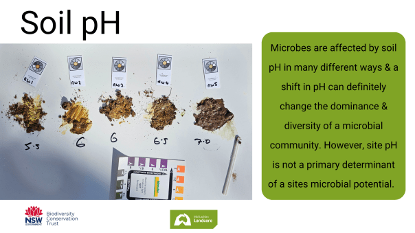
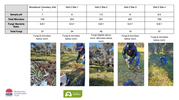
In addition, we tested soil pH for each sample, recorded collection date, temperature, sampling date and a brief site history where possible.
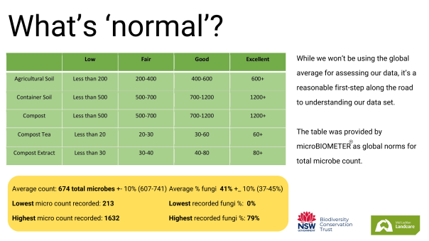
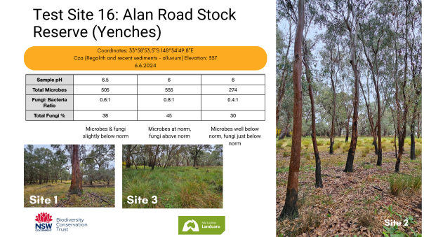
The microbiometer® returns a result for total number of microbes based on the mass of carbon present in the solution tested. We see that as a number, most commonly between 200-1200+. An excellent result for agricultural soil is one that’s above 600 so when our global average came in at 674, it felt like we were on the right track.
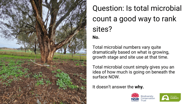
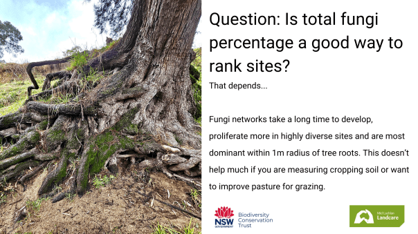
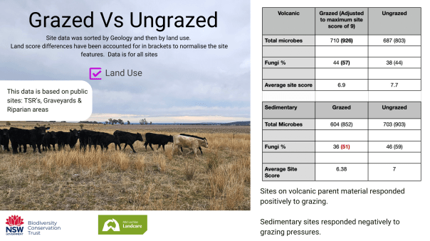
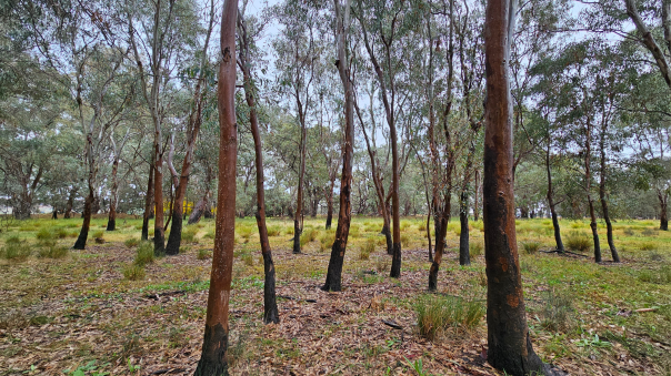
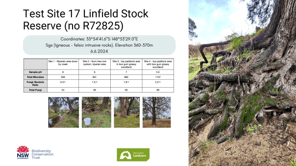
Existing scientific research taught us fungi networks take a long time to develop, proliferate more in highly diverse sites and are most dominant within a one meter radius of tree roots and our experimental data was in alignment with that. Some of our highest results came from the area around established gum trees that had experienced light grazing. One notable result was from Linfield Travelling Stock reserve near Cowra, a site resting on volcanic rock at an elevation of 360-370 meters and one infrequently grazed. We recorded a reading of 1157 total microbes, 2.2:1 ratio of fungi: bacteria and a total fungi percentage of 69% under one of the established eucalyptus trees.
Our trial did not have enough pH diversity for us to make any conclusions about the role of pH and microbe numbers or ratio but microbe numbers were low in sites with known salinity issues.
When viewing results from a fungi: Bacteria ratio perspective, we tended to find the sites that were dominated by fungi were more likely to be diverse in their flora, be grazed either lightly or not at all and be in close proximity to trees or deep rooted perennial grasses – especially native red grasses. Fungi dominant sites were typically among our most active sites with microbe counts over 1000. Fungi dominance reduced in line with total microbe numbers.
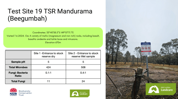
Finally we found underlying site geology to be a strong predictor of a sites ability to sustain a healthy microbiota with sites based on volcanic rocks appearing more resilient and productive than sites based on geological sediments. Our average total microbe count and fungi percentage for volcanic sites was 726 and 42% vs 467 and 34% for sedimentary sites. Another way this could be interpreted is it appeared the sites with underlying volcanic geology were more resilient to land-use pressures than sites built on sedimentary-type geology.
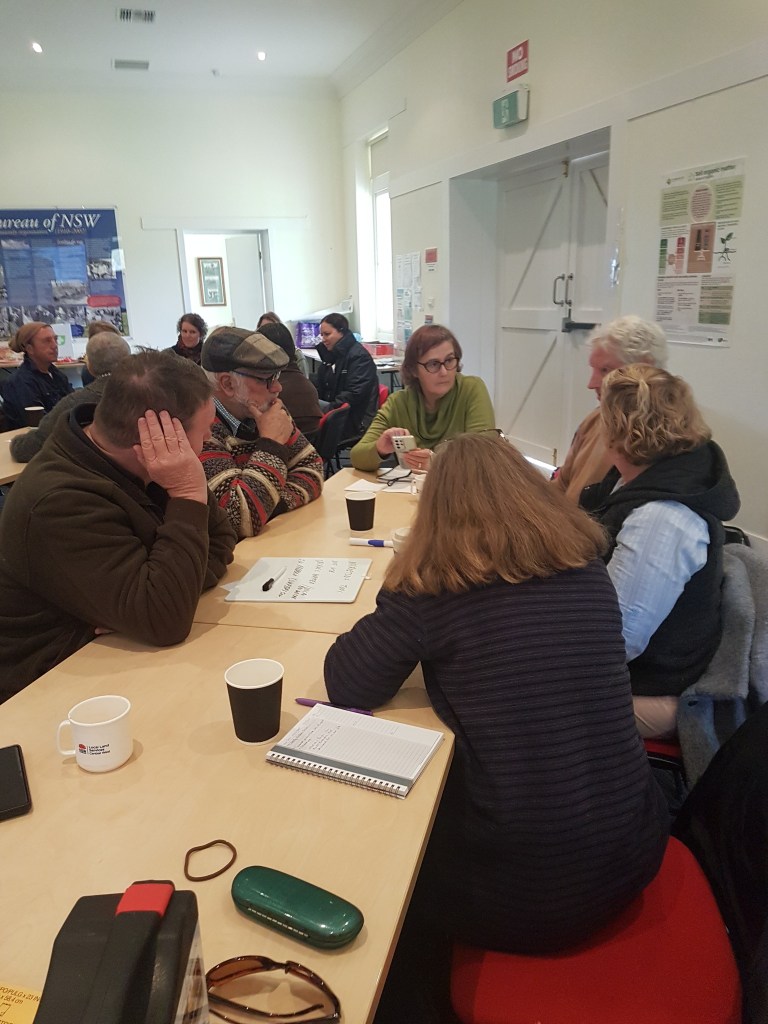
On July 19th 2024, we presented the results of our trial at a booked-out field day in Cowra and sought feedback from our community of farmers, conservationist and community gardeners by asking what we should do next with this technology/project.


The feedback was overwhelmingly supportive with many wanting more information on how the Microbiometer® stack up against standard soil test methods as well as more information on what other farmers had found with the test.
Results:
- How reliable is microBIOMETER data?
Microbe populations can shift and change quite rapidly meaning it’s important to standardise the time between collecting the sample and analysing it. Quoting the DPI’s Soil Biology Basics fact sheet:
‘Populations of microbes can boom or bust in the space of a few days in response to changes in soil moisture, soil temperature or carbon substrate. To gain advantage in this process, many microbes release antibiotic substances to suppress particular competitors. In this way some species can suppress other disease-causing microorganisms’
We quickly found that analysing samples in the field was difficult due to light conditions, other weather events (rain, wind etc) and the space and time requirements needed for each test.
Our method consisted of bagging up samples in zip lock bags then storing them in refrigerated conditions (approx 5-7C) for between 2-3 days before testing them. It was hoped the cooler temperatures plus sealed-in moisture would provide enough stability of the environment to make the test results meaningful.
As we used this protocol for all samples, the results yielded can be compared against each other although it’s likely the microbe communities in our soil samples are somewhat altered from when the samples were first collected. The assumption made at this point is our sample collection & storage protocol was standardised enough that all samples would be affected and altered similarly.
Our five-factor site analysis backs up the above assumption as when results were analysed this way, patterns emerged that made sense given what we know about microbes and what we could measure of each site. These patterns were not immediately evident when other site factors were not considered.
Overall, the microBIOMETER produces data that’s reliable although we’d caution in relying too heavily on the numbers alone and instead, focus on whether total count was low, medium or high (for this type of environment) and the fungi: bacteria ratio.
2) Does taking a microbiological assessment provide us with insights about a site that we wouldn’t be able to get through more traditional test methods?
We believe so although we’d caution against relying on a one-off biological measure for long-term land management due to how rapidly a microbial community can change.
Our goal as a Landcare community is to protect, preserve or restore ecosystems so it makes sense to consider the soil microbiome in that equation. The microBIOMETER provides a cost-effective and rapid way to gain an insight of the soil’s biology.
3) Is the microBIOMETER a useful addition to the soil testing tool kit?
This test provides us with another perspective on the sites current health status and future potential in a way that’s cost and time effective. For those reasons it becomes a question of ‘why not?’ rather than ‘why bother’.
Conclusion:
Overall we feel this project has successfully delivered insights into how the Mid Lachlan region’s soils microbiome functions with respect to landscape features and management decisions although it’s clear there’s still a lot more work to do. Also, after putting the microBIOMETER through it’s paces we believe it’s a useful tool for those looking to gain a deeper understanding of their soil. Our advice would be to use the microBIOMETER or similar microbiology assessment tool/ protocol alongside your existing soil testing tools, at regular intervals to monitor the effect management decisions have on the soil microbiota over time.
This project and our event was possible thanks to the shared work of the NSW Biodiversity Conservation Trust and Landcare NSW under the Private Land Conservation Matters project.


